Rapid assessment of flood extent and damages in Quang Nam province by using Sentinel-1 data
Abstract
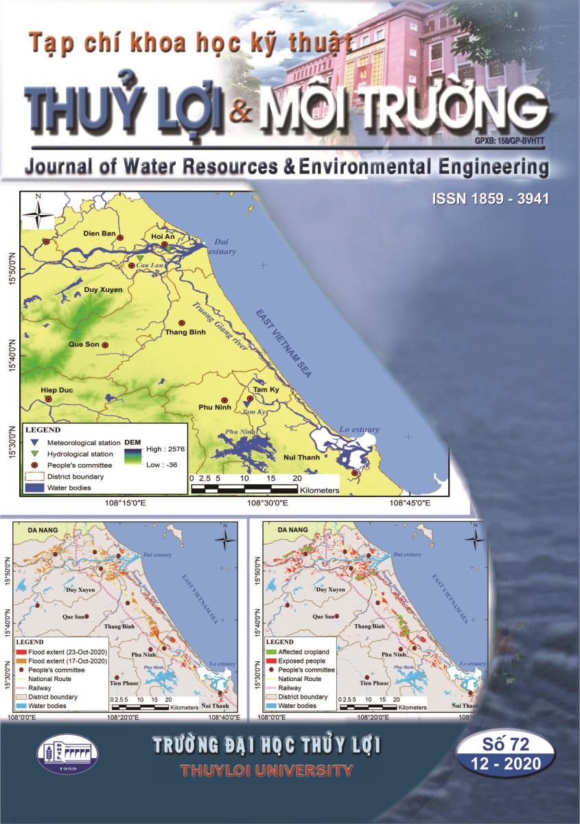
Assessing flood extent and damages is paid great concern from both authorities and researchers because of flood frequency and consequences. Quang Nam, a Central Coast province of Vietnam, experiences enormous tropical storms. The year 2020 is considered the historic storm year, destroying many properties and public constructions and causing many injuries and fatalities. Therefore, rapid assessment of flood extent and damages can provide a timely response to heavy flood events. In this study, the authors adopted the Google Earth Engine (GEE) platform to quickly extract flood extent from Sentinel-1 images and rapid assessment of flood damages. Sentinel-1 images covering Quang Nam province were acquired to assess the flood events on 17 and 23 October 2020. The results show that on October 17th, 2020, 14036.07 ha of Quang Nam province has suffered from the flood, affecting 80667 people, 2242 ha of cropland, and 648 ha of urban area. After six days, on October 23rd, 2020, flooded areas and exposed people reduces to about 66.5% and 72.5%, respectively, while affected cropland and urban area were not recorded. Decision-makers can base on the excellent results of this research to give efficient and timely solutions to respond to floods and their consequences.